Guiyang launches pilot basic surveying and mapping projects

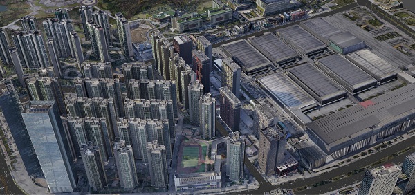
The Guiyang Bureau of Natural Resources and Planning completes the monomer 3D model of Guiyang. [Photo/guiyang.gov.cn]
The Guiyang Bureau of Natural Resources and Planning started pilot projects for new-type basic surveying and mapping in Guiyang, capital of Southwest China's Guizhou province, in 2020, marking the start of the development of Guiyang's new-type basic surveying and mapping system.
The pilot projects were implemented in the five-square-kilometer area around Guanshanhu Park and the Guiyang International Conference & Exhibition Center. With new-type basic surveying and mapping technologies such as oblique photogrammetry and 3D laser scanning, the bureau completed the surveying and mapping standard system of Guiyang over the past year.
The system includes 3D data that can be automatically identified, distributed and shared by computers. It can realize the visualized and delicate management of the city's natural resources, and provide references for the city's public service management.
In the future, Guiyang will continue to build a product technology system, standard system, and production organization system for new-type basic surveying and mapping, expand services for industries related to natural resource management, and provide references for new-type basic surveying and mapping systems under different geographical conditions.
Presented by China Daily.
黔ICP备05001922号-3
