Guizhou hosts UAV skills competition

A theoretical test covering UAV aerial surveying principles and relevant regulations is held. [Photo/WeChat account of Guizhou Department of Natural Resources]
The 2025 Guizhou unmanned aerial vehicle (UAV) skills competition for the surveying and mapping industry was held in Guiyang from June 14 to 15. It marks the first UAV-focused vocational competition organized by the province's natural resources authorities.
The event, which attracted nearly 150 participants in 30 teams, aims to cultivate skilled professionals and serve as a platform for industry exchange.
The contest featured two main components: a written exam and hands-on operations. The theoretical test covered UAV aerial surveying principles and relevant regulations, while the practical section simulated real-world emergency scenarios in Guizhou's mountainous terrain. Participants were evaluated on their ability to conduct drone imaging, data processing, and 3D modeling.
After two days of intense competition, six teams stood out.

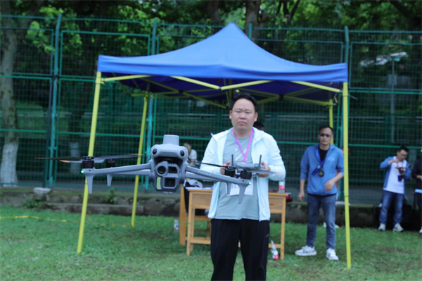
A participant operates a drone during the competition. [Photo/WeChat account of Guizhou Department of Natural Resources]
The Institute of Surveying and Mapping at Guizhou Geology and Mineral Exploration Bureau won the first prize. The second prize went to Zunyi Water Resources and Hydropower Survey and Design Institute and the No 104 Geological Team of the Guizhou Geology and Mineral Exploration Bureau. Third prizes were awarded to Guizhou First Surveying and Mapping Institute, the No 106 Geological Team of the Guizhou Geology and Mineral Exploration Bureau, and the Guizhou Tianbao Ecology Co. Twelve other teams, including Guiyang Surveying and Mapping Institute, received excellence awards.
Presented by China Daily.
黔ICP备05001922号-3
